The Best Shaded Trails in Austin for Summer Morning Workouts
A trail-by-trail breakdown of canopy coverage, surface heat, and heat-index thresholds for residents who actually need to run or walk outside in July
The Best Shaded Trails in Austin for Summer Morning Workouts
A trail-by-trail breakdown of canopy coverage, surface heat, and heat-index thresholds for residents who actually need to run or walk outside in July
Why “Shaded Trail” Needs a Better Definition in Austin
Every summer, the same generic roundups circulate. They name the Barton Creek Greenbelt, check the box, and move on. What they don’t tell you is which section of the Greenbelt holds shade past 8 a.m., which surfaces turn into heat radiators the moment the sun clears the canyon wall, or how a trail rated “shaded” in April becomes a legitimate danger in July.
Shade is not binary. On Austin’s hill-country terrain, it depends on at least four variables that interact differently every morning: the density and species of the tree canopy overhead, the orientation of the canyon walls that create morning shadow, the surface material underfoot and how aggressively it absorbs and re-radiates heat, and the time of day relative to your specific latitude in late June and July. A trail segment sitting comfortably in canyon shadow at 7:00 a.m. can be fully exposed—limestone reflecting back at you from both the ground and the creek ledges—by 9:15. That 75-minute window is the difference between a productive run and a medical situation.
This guide is built for Austin residents who don’t have the option of skipping exercise until October. Segment-level canopy assessments, surface heat risk, approximate shade-clearance timing, water access status, and a turn-back protocol grounded in NOAA heat index data rather than general encouragement to “listen to your body.” Where specific details—fountain maintenance status, post-flood trail conditions—could change week to week, those are flagged for same-morning verification.
Understanding the Shade-and-Surface Variables
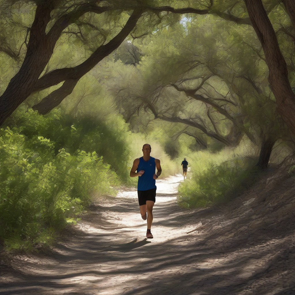
Canopy quality comes first. Riparian woodland—the cypress, sycamore, cedar elm, and pecan corridors along creek drainages—provides far more overhead closure than the sparser upland cover of juniper and live oak on Austin’s exposed limestone ridges. A healthy creek corridor can approach complete shade during morning hours. Upland juniper-oak on rocky slopes has gaps everywhere.
Trail surface matters more than most guides admit. Natural surface trails—packed dirt, crushed granite—run dramatically cooler underfoot than asphalt. In direct sunlight, asphalt radiates absorbed heat back against your legs and compounds the ambient heat index. Limestone ledge sections along creek trails, popular as swimming access points, are particularly punishing once the sun hits them directly. A flat limestone shelf that feels fine in morning shadow gets hot enough to be a real hazard in minimal footwear by mid-morning. If you’ve ever hopped onto one of those creek ledges at Barton in the early afternoon, you know exactly what I mean.
Canyon wall orientation determines your shade window. East-facing canyon walls cast their shadow westward in the morning hours; trails running along the base of an east-facing wall get real protection until the sun clears the ridge. This is why the upper Barton Creek Greenbelt, which cuts through east-west oriented limestone canyons, offers better early-morning protection than sections that run more north-south in open exposure.
Sun-clearance timing estimates in this guide rely on Austin’s summer sun angle and typical canyon depth. They’re working approximations. Exact timing shifts by 10–15 minutes depending on canyon depth, tree height, and how far you are from the canyon wall. Treat every estimate below as earlier than listed if you’re out in the open.
Barton Creek Greenbelt: The Best and Worst of the Same Trail
The Greenbelt is Austin’s most-used natural trail system and it earns that reputation. But the “shaded” label applies unevenly across it—and that unevenness is exactly what the generic roundups never bother to explain.
Upper sections near Spyglass and Gus Fruh are the summer sections. The canyon here is relatively deep and east-west oriented, with dense riparian cover from juniper, live oak, and sycamore along the creek corridor. On a typical July morning, the canyon walls and tree canopy combine to hold shade along the creek-level trail from the Gus Fruh access point (2600 Barton Hills Dr.) until roughly 8:30–9:00 a.m. Once sun clears the east ridge, the open limestone sections heat fast. You can extend your window by staying close to the creek and under the sycamore canopy wherever the trail allows. The surface here is predominantly natural limestone and packed dirt, with exposed limestone at creek crossings. Heat risk is moderate until direct sun hits; after that, the limestone ledge sections near the swimming holes get hot enough to be a secondary concern in thin-soled footwear.
The water fountain at Gus Fruh is confirmed at that location but has been inconsistent historically. Verify before you go. Don’t treat it as your backup plan. Carry your water either way.
Lower sections approaching Sculpture Falls and Twin Falls demand a different calculation. The trail opens considerably, with less canyon depth and more exposed limestone shelf. Direct sun reaches the surface noticeably earlier—closer to 7:30–8:00 a.m. in July for the most exposed segments. The swimming holes at Sculpture Falls make decent cooling stations, but routing through these sections as a running trail in July heat is a different proposition than the upper canyon. Think twice.
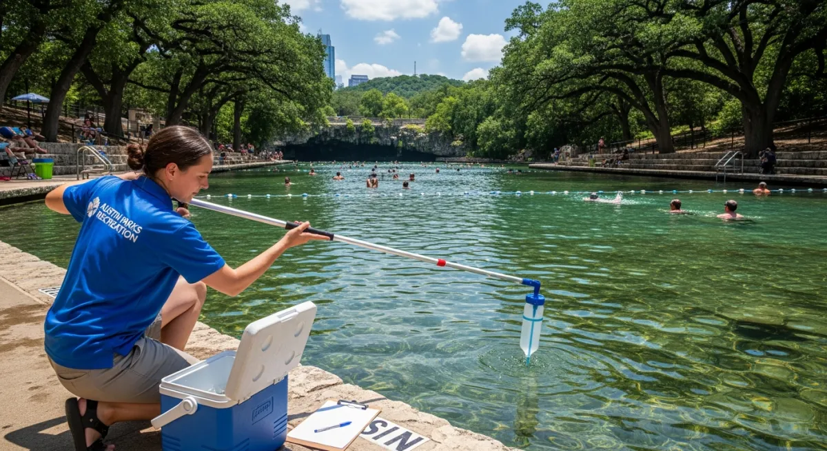
The lower Greenbelt sections also sustained damage in the May 2024 flooding events. Check Austin 311 or contact the Austin Parks & Recreation ranger station before heading down there. APR rangers maintain a summer presence at the Greenbelt and provide the most reliable same-day conditions information.
Lady Bird Lake Hike-and-Bike Trail: Canopy by Compass Direction
The approximately 10-mile loop around Lady Bird Lake is commonly described as Austin’s quintessential shaded urban trail. That description is accurate for about half of it. The other half gets a pass because the views are good enough that people forget to notice they’re baking.
The north shore between the South First Street bridge and the Lamar Boulevard bridge carries the best canopy on the entire loop, particularly near the Shoal Creek confluence. Morning shade on this section holds until approximately 8:00–8:30 a.m. in June and July, aided by the lake’s cooling effect on ambient temperature.
The south shore—Auditorium Shores east toward Longhorn Dam—is largely open parkland. Grass, scattered trees, not a canopy trail. Direct sun reaches much of it by 7:30 a.m. or earlier in July, and lake humidity amplifies the heat index quickly. If you’re running the full loop, be finishing your south shore section by 7:30 a.m. in peak summer. Plan it, then stick to it.
The route mixes paved asphalt and crushed granite. Asphalt sections retain heat aggressively—a 6:30 a.m. start on pavement that was fully baked the day before will feel warmer than you expect before ambient temperature even peaks. Heavy multi-use traffic is the other reality on this trail. The 6:00–9:00 a.m. window on summer weekdays brings cyclists, runners, and dog walkers sharing paved sections with no physical separation in most areas. Conflict points near the South First bridge and the Pfluger Pedestrian Bridge are real; be aware of them. Dogs must be on leash.
Water fountains are located near the Auditorium Shores pavilion, near the Barton Springs Road trailhead, and near the Pfluger Pedestrian Bridge. Verify operational status before treating any of them as a reliable mid-run source.
Bull Creek District Park: The Shadiest Canyon Most South Austinites Skip
Bull Creek District Park at 6701 Lakewood Dr. in North Austin is the most legitimately shaded natural trail option in the city on the metrics that matter for summer use. It’s also chronically undercovered in Austin outdoor writing—possibly because it sits outside the South Austin gravitational pull that dominates trail conversation. Either way, you’re missing out.
The creek corridor runs through a riparian woodland of bald cypress, cedar elm, and pecan—the densest canopy combination on any Austin public trail. Mature cypress provides nearly complete overhead closure, and Bull Creek has the mature specimens. The canyon here is narrower and deeper than the upper Greenbelt, which means morning shade persists longer: credibly until 9:00 a.m. or slightly beyond for creek-level routing in July, though that drops significantly if you move to the upland sections.
Stay on the lower creek-adjacent trail. The upper park road sections are far more exposed and not where you want to be in July. The lower trail has more technical footing—limestone rock, root crossings, some creek boulder-hopping—but that’s the trade. The limestone swimming holes also offer a genuine post-workout recovery option that doesn’t exist in quite the same way at Lady Bird Lake.
Weekday mornings here are quiet compared to Barton Creek. Weekend parking at the main lot on Lakewood Drive fills by 9:00 a.m. in summer, so arriving early isn’t optional if you want both the space and the shade. Restrooms and water are available at the main park area. Confirm fountain status before your visit—maintenance has been inconsistent. Austin Parks & Recreation lists Bull Creek District Park at austintexas.gov/parks.
Walnut Creek Metro Park: The North Austin Option Nobody Writes About
Walnut Creek Metro Park at 12138 N. Lamar Blvd. exists. North Austin residents currently drive south to the Greenbelt or Lady Bird Lake when a functional trail system sits much closer—and that commute through summer traffic during peak heat hours doesn’t make a lot of sense.
The creek corridor is the summer route. Walnut Creek itself runs through a riparian woodland that provides real canopy along the water. It’s spottier than Barton Creek—more gaps where the trail crosses open areas—but the creek-adjacent sections are a genuine step up from the park’s open meadow routing, which should be treated as exposed past 7:30 a.m.
The park contains both paved connector paths and a mountain bike trail network. Walnut Creek is a designated mountain bike park. Confirm current multi-use designation on specific segments before running or walking them, as routing has evolved with the park’s growing bike use. The paved paths are clearly appropriate for pedestrians.
Restrooms and water are available at the main parking area on N. Lamar. Don’t assume water access beyond the trailhead. This trail works if you live in North Austin and want to skip the drive south through summer traffic. That’s its purpose and it serves it well.
Side-by-Side Trail Comparison
| Trail | Best Canopy Section | Surface Type | Shade Ends (July est.) | Water Access | Weekday Morning Crowds |
|---|---|---|---|---|---|
| Barton Creek Greenbelt (upper) | Gus Fruh to Spyglass area | Natural limestone, packed dirt | ~8:30–9:00 a.m. | Gus Fruh fountain (verify) | Moderate 6–8 a.m.; heavy after |
| Barton Creek Greenbelt (lower) | Sculpture Falls area | Exposed limestone shelf | ~7:30–8:00 a.m. | None confirmed mid-trail | Moderate |
| Lady Bird Lake (north shore) | Lamar to South First bridge | Mixed: asphalt + crushed granite | ~8:00–8:30 a.m. | Auditorium Shores, Barton Springs Road trailhead, Pfluger Bridge area | Heavy 6–9 a.m. |
| Lady Bird Lake (south shore) | Auditorium Shores east | Asphalt dominant | ~7:30 a.m. or earlier | Auditorium Shores | Moderate |
| Bull Creek District Park | Creek corridor, lower trail | Limestone rock, soil | ~9:00 a.m. or later | Main park area (verify fountain) | Light weekdays; fills weekends |
| Walnut Creek Metro Park | Creek-adjacent sections | Mix of packed soil, paved connector | Creek sections shadier than open meadow; specific timing not established | Main parking lot only (verify) | Light to moderate |
What to Bring
The generic “bring water” advice understates the actual requirement. The working minimum is 20 ounces per 30 minutes of moderate exertion in Austin summer heat. For a 60-minute run, that’s 40 ounces. A standard single-bottle hydration pack won’t cut it. Carry a minimum of 60 ounces if you’re out an hour or longer, and treat that as a floor, not a target.
Electrolytes are separate from hydration. At high sweat rates in humid heat, you’re losing sodium and potassium fast enough that plain water alone can cause hyponatremia during long efforts—a condition where your blood sodium drops low enough to produce nausea, confusion, and worse. Carry electrolyte tablets or a sodium-containing drink mix for anything over 45 minutes. This is not optional.
UPF 50+ clothing covers more surface area more consistently than sunscreen reapplication allows during a run. Apply any sunscreen before departure—not in the car, not at the trailhead.
For real-time conditions, Austin 311 is the correct tool for trail and park closures the morning of. TrailForks shows current trail conditions and recent user activity. For Barton Creek specifically, APR rangers often post same-day updates; call the ranger station directly if conditions are uncertain after flooding or storms.
Know your nearest trailhead exit before you start. On Barton Creek, that means knowing the Gus Fruh, Spyglass, and Loop 360 access points by location—not just by name. On Lady Bird Lake, exits are frequent and straightforward. On Bull Creek and Walnut Creek, they’re fewer; in an emergency your return is largely the same trail you came in on. That’s a strong argument for conservative turnaround timing on both.
Parking fills by 7:30 a.m. on summer weekends. Arriving after 7:00 a.m. on a Saturday in July means scrambling. There’s no workaround.
Heat Index Thresholds and When to Turn Back
NOAA defines heat index risk in four bands: Caution at 80–90°F, Extreme Caution at 90–103°F, Danger at 103–124°F, and Extreme Danger above 125°F. These account for the combined effect of air temperature and relative humidity on the body’s ability to cool itself. As part of our health & wellness coverage, heat thresholds like these are a recurring factor in Austin’s summer safety picture. Here is what those bands look like on Austin streets in July, by the clock:
Around 6:00 a.m. you’re in NOAA’s Caution zone. This is your window. Austin’s late-June sunrise is approximately 6:23 a.m.; by early August it shifts to approximately 6:45 a.m.
By 7:00 a.m. the heat index climbs into Extreme Caution as temperature rises. You should be finishing efforts, not starting them.
By 8:00–8:30 a.m. you’re in the middle of the Extreme Caution range. Trail surfaces have started radiating absorbed heat from prior days. Exertion compounds your effective heat load well above ambient.
By 10:00–11:00 a.m. the heat index routinely hits NOAA’s Danger threshold in July. Austin’s average July high is approximately 98°F; during the 2023 heat event records exceeded 110°F, which made every prior summer feel almost reasonable by comparison. Heat exhaustion and heat stroke risk are sharply elevated.
The turn-back rule used in this guide: leave the trail when the heat index reaches 103°F, or when you’ve consumed more than half your water—whichever comes first. These are thresholds, not suggestions. Once you cross either one, your safety margin is gone.
Austin Parks & Recreation has historically advised trail use before 8:00 a.m. or after 7:00 p.m. during peak summer. Treat the 8:00 a.m. mark as a hard cutoff for anything beyond very light walking with full water access.
If you experience headache, stop sweating despite the heat, feel confused, or get nauseated on the trail, those are signs of heat exhaustion moving toward heat stroke. Stop. Get into shade. Drink water with electrolytes if you’re alert. Call 911 if symptoms don’t improve quickly. For residents who need climate-controlled relief instead, Austin’s network of cooling centers in 2026 maps which neighborhoods have access and which don’t. This is exactly why I keep emphasizing that you memorize your nearest exit before starting—not as a procedural nicety, but because it matters at precisely this moment.
Before You Go: Verify Conditions the Morning Of
This guide gives you a stable framework. The morning’s specific facts require verification.
Check Austin 311 for current trail closures, especially for Barton Creek after any rain in the preceding 48 hours. Creek crossings become impassable and lower trail sections close regularly after summer thunderstorms. TrailForks user reports from the last 24–48 hours will tell you about Barton Creek and Walnut Creek conditions. If you’re heading to the lower Barton Creek sections, call the APR Barton Creek Greenbelt ranger station for same-day conditions—those sections sustained damage in the May 2024 flooding and their status has been variable ever since.
Confirm fountain status at Gus Fruh and Bull Creek before treating either as a mid-run water source. Carry full water regardless. Check austintexas.gov/parks for current APR summer advisories; the 2025 advisory language should be confirmed there directly, since specific thresholds can shift year to year.
Items in this article that require ongoing verification: Gus Fruh fountain operational status; Bull Creek fountain and restroom status; lower Barton Creek trail conditions post-May 2024 flooding; Walnut Creek trail use designations for specific mountain bike segments; current APR 2025 summer advisory language.
The core framework here—shaded canyons with riparian canopy, east-facing walls, conservative timing, and full water carry—is stable. The operational details are not. Treat them accordingly.